U3A FIELD TRIP TO LA PALMA, CANARIES 2014
Day 5, Wednesday 4th March
This trip took us to the South of the Island of La Palma where the focus was the Volcan Tenequia. The path leading to the crater was comprised of lapilli – very small spherical stones of lava which had been worn down through the action of the elements, especially the wind. To the north and left of us rose the large cinder cone of the Volcan San Antonio which erupted in 1677 and buried a hot spring which we were intending to visit. This was not possible because of poisonous gases emerging from it. The reason for the hot spring – quoting from Geoffrey, ”Malvern geothermal gradient is about 25 degrees/km and here it is 300 degrees/km (2.5km top to bottom so the temperature is ~ 750 degrees at sea level).”
We progressed towards Teneguia to our right. It erupted between 27th October and 19th November 1971, had 7 vents rather than one single cone, and produced 400,000 cubic metres of lava. The event was preceded and accompanied by earthquakes though it was not particularly violent in volcanic terms (VEI scale 1 as opposed to super volcanos at VEI scale 8). It was pointed out to us that the rock we were walking on was the rough, hardened basaltic lava from Tenequia and, strangely in the field of geology, was actually younger than we were!
Gases are also significant in volcanic eruptions, particularly steam and carbon dioxide. Other poisonous ones are sulphur dioxide, hydrogen sulphide, and hydrogen fluoride, and two people were killed by asphyxiation as a result of this eruption.
Teneguia is constantly being monitored in three ways to indicate a possible forthcoming eruption.
1. Pipes in the ground take samples of gas emissions, for changes in the ratio of two helium isotopes,
2. GPS systems measure the changing height of ground level.
3. There is a network of seismometers
Finally as we approached the main volcanic cone, we were given the task of finding fumeroles (vents from which gas is currently still escaping in the form of hot air and sulphur dioxide. Several possibilities proved inconclusive as far as I was concerned but other members of the group did find several vents from which hot air (70 degrees C?) was emerging.
During our walk, we noticed volcanic rocks of various colours indicating the different compositions of minerals etc. coming from the same volcano at different times. Some rocks were heavy and some light in weight. Some lavas contained zenoliths – small fragments of rock from the sides of the volcano which had been blown up by the explosion and become embedded in the lava. Much of the cooled sharp and jagged lava is known as A'a (because that’s what you say if you walk on it bare-footed, we were told!) Other lava forms smooth wrinkles and is known as Pahoehoe or ropey lava.
Also, a few plants were beginning to colonise some areas – possibly there was water, shelter, and perhaps finer dust to act as a growing agent. However, there were still vast areas of bare lava with no growth, even after 40 years. It will be a long time until this region looks as green as the rest of the island.
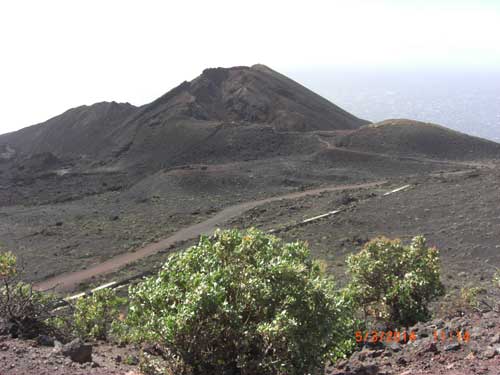
The main cone of Tenequia with a few plants starting to colonise.
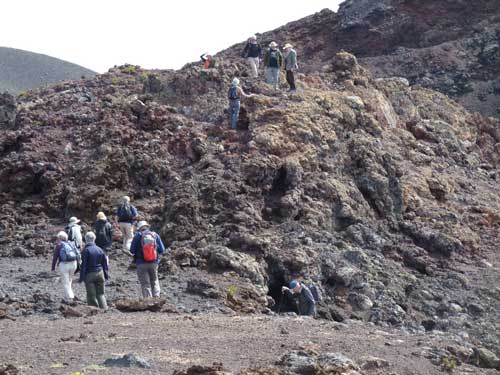
The group exploring Tenequia.
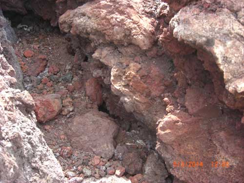
A fumerole with red coloused rock, probably containing iron.